Tides and currents
High and low tides, a 24-hour curve and the week ahead for 5,000 tide stations, slack water for 2,300 current stations, and a crossing planner that picks the best time to go.
See how the moon makes tides →
Tides, campsites, fishing times and marine weather for paddlers, anglers, boaters and coastal explorers. Free to use online; offline maps for trips out of signal come with a Coast Map Pass.
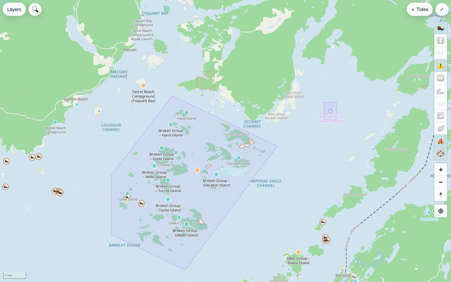
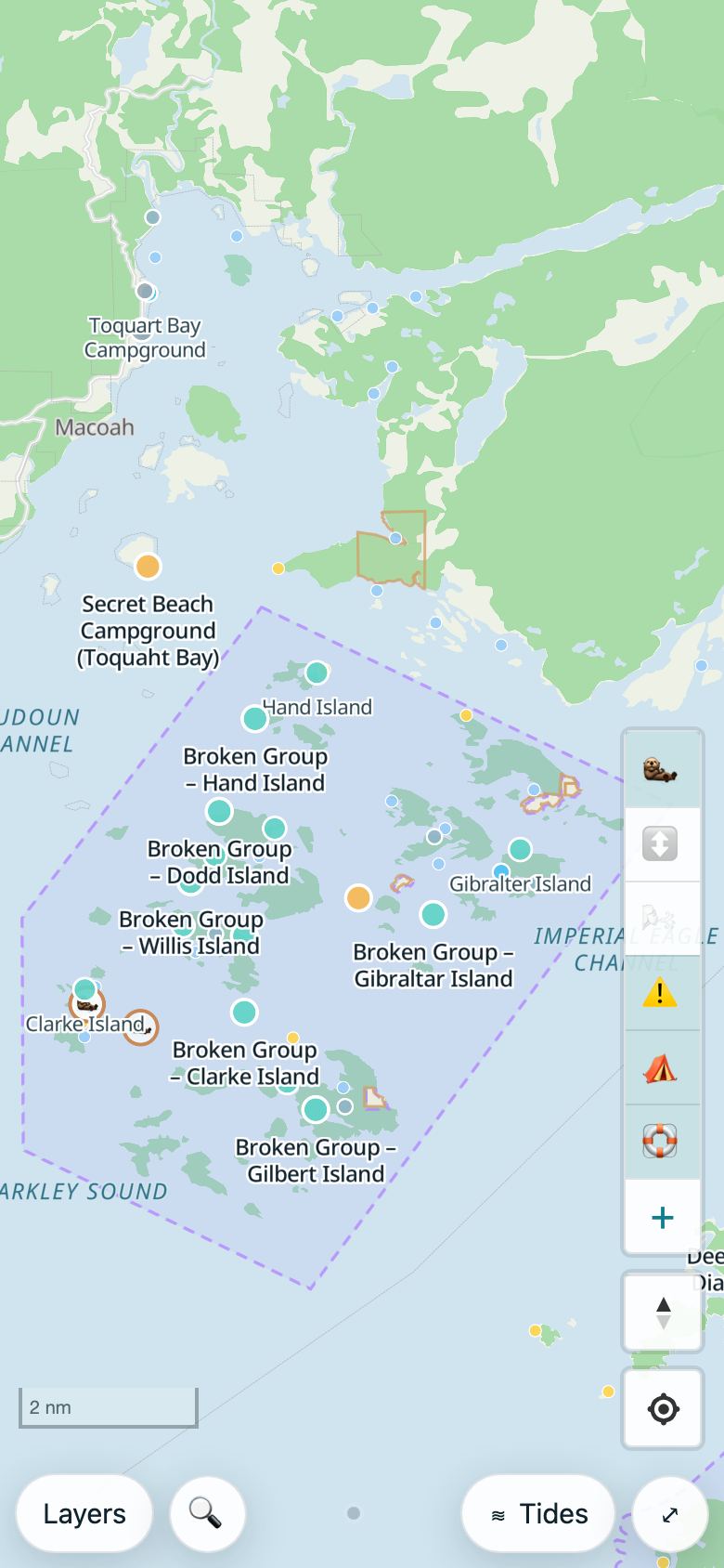
The same map on a computer and on a phone: kayak campsites in the Broken Group, Barkley Sound.
High and low tides, a 24-hour curve and the week ahead for 5,000 tide stations, slack water for 2,300 current stations, and a crossing planner that picks the best time to go.
See how the moon makes tides →A Fishing tab with bite windows and the best hours of the day, and why. Local rules, fishing piers on the map, and a private catch log that shows your own patterns.
More about fishing →A heads-up before high tide, low tide, slack water or a good fishing window, from 15 minutes to 2 hours ahead.
Hourly wind and gusts, waves, water temperature, rain radar and marine warnings on the map, plus the official marine forecast for your area.
Campsites coloured by what you need before landing: a fee or reservation, a permit or protocol, or free backcountry. Boat launches and marinas too.
The best daylight low tides for the month, shellfish harvest areas and, where they're published, today's closures.
With a Coast Map Pass, pick your region once and the map, campsites and a year of tide tables download to your phone for trips out of signal.
Where sea otters and river otters have been seen, filterable by season, with the best spots to look.
Star the stations you'll pass, then “Prepare for trip” saves their forecasts. See where your phone is likely to have signal on the water.
Canada: Vancouver Island and the Gulf Islands, the BC North Coast and Haida Gwaii, Lake Superior, Georgian Bay, Lake Ontario, Lake Erie, the Thousand Islands, Muskoka and the Kawarthas, the Upper St. Lawrence from Quebec City, the St. Lawrence estuary and Gaspé, the Gulf of St. Lawrence, the Bay of Fundy, Nova Scotia and PEI, Newfoundland.
United States: Puget Sound and the San Juans, the Oregon coast, North, Central and Southern California, Southeast Alaska, Prince William Sound, Kodiak and the Katmai coast, Hawaii, Maine, Cape Cod, Long Island Sound, the New Jersey Shore, Chesapeake Bay, the Outer Banks, the Lowcountry, Northeast Florida, the Indian River Lagoon, the Florida Keys, the Florida Gulf Coast, the Gulf Coast, Texas, Puerto Rico and the US Virgin Islands, Lake Michigan, Lake Huron, Lake Champlain, the Apostle Islands.
Europe: Norway (the western fjords, Lofoten, Oslofjord, Svalbard), Sweden (Stockholm archipelago, Bohuslän), Finland (Turku and Åland, Helsinki, Lake Saimaa), Denmark (South Funen), Germany (Rügen), the Netherlands (Wadden Sea, Zeeland), Ireland, Croatia (Istria, Dalmatia), Greece (Ionian Islands, Cyclades), Sardinia, Corsica, the Balearic Islands, the United Kingdom (Cornwall and the Isles of Scilly, Pembrokeshire and Gower, Skye), France (Brittany), Spain (Galicia), Portugal (the Algarve and the Alentejo coast).
Caribbean, Asia-Pacific and South America: the Bahamas, the British Virgin Islands, Belize, Fiji, New Zealand (Abel Tasman and the Marlborough Sounds, Bay of Islands and Hauraki Gulf, Fiordland), Australia (the Whitsundays, Moreton Bay, Jervis Bay and the NSW South Coast, Tasmania’s east coast), Thailand (Phang Nga Bay), the Philippines (Palawan), Vietnam (Ha Long Bay) and Chile (Chiloé).
Tides and forecasts work online for every station in these countries; downloads are by region. In the UK, Brittany, Galicia, Portugal, New South Wales, Tasmania, Asia and Chile the tides are modelled from satellite data, not official predictions. In English, French, Norwegian and Swedish. See what each region has.
Tide times for every station: a week of high and low tides for 5,000 stations, one page each.